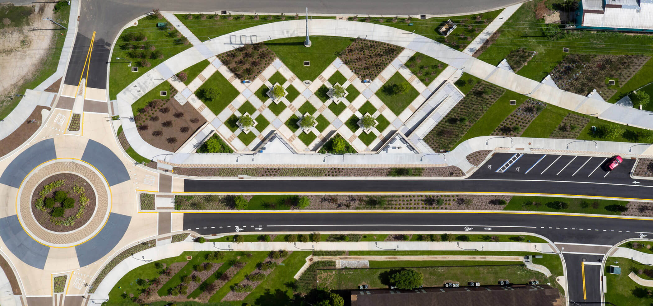
The FAMU Way Corridor, a transportation project managed by the City of Tallahassee (“City”) extends from Adams Street to Pinellas Street in Tallahassee, Florida. This segment was combined with the Capital Cascades Trail project managed by the Blueprint Intergovernmental Agency (“Blueprint”), a joint Leon County — City of Tallahassee agency. The two projects were implemented on parallel tracks with the goal of delivering one seamless project. The FAMU Way Corridor was envisioned as a way to create a new east-to-west roadway between the current end of FAMU Way at Wahnish Way and Lake Bradford Road, a distance of approximately 1.5 miles separated into four phases. The project was additionally tasked with adding enhancements to the existing FAMU Way corridor between Wahnish Way and Martin Luther King Jr. Boulevard. Prior to the project, the facility was underutilized and underappreciated as a gateway to one of the nation’s most honored Historical Black Colleges/Universities, Florida A&M University (“FAMU”). The existing corridor offered few amenities for recreation and lacked vital bicycle facilities. Moreover, the lack of landscaping and a steep-walled drainage canal created an avenue with little aesthetic appeal.
The challenge posed by the City Commission — to consider aesthetics as importantly as function — prompted action on the planning and design for the FAMU Way Corridor. The design team along with multiple agencies, embraced the FAMU Way design challenges by balancing the transportation needs of the community with the potential aesthetic and social value of the corridor. In total, the combined projects represent in excess of a $25 million dollar public investment of which $9 million dollars was allocated to hardscape, landscape, and irrigation enhancements.
Concurrently with the community involvement component of the project, an urban design studio from FAMU School of Architecture provided six initial concepts that formed the original vision for the project. From this studio project the design team derived four overarching themes that guided the overall design of the project: Elements of Water; History and Heritage; Redevelopment and Activity; and Color, Vibrancy and Playfulness. The multiuse trail serves as the backbone for the creation of three distinct zones and application of the design themes. When completed, the multiuse trail will connect Cascades Park to the Tallahassee-St. Marks Historic Railroad State Trail, which ends in the coastal community of St. Marks. Anchoring the western end of the project, Railroad Square Arts Park complements the constructed improvements within the first zone. A year-round multiuse event space hosts farmers’ markets, artists and special community events. The ADA accessible trail also includes a universally accessible playground with interactive features for children of all ages and a refuge trail mister station to cool off. Dedicated areas within the Heritage zone have been reserved for future public sculpture and educational kiosks that will highlight the influence African-Americans have had on the city. The diagonal bands of integral color concrete that bisect the sidewalk and trail have been placed as visual cues to alert trail goers of these unique secondary spaces.
To the east is Anita Favors Thompson Plaza at Lake Anita, which is named after the former city manager, one of several champions of this project. The plaza is a terraced gathering area within a stormwater management facility designed to be a flexible space with myriad of opportunities for gathering. Once the sun sets, the programmable LED lights concealed within a cantilevered cap of the stormwater facility wall illuminate the five-acre body of water, setting the tone for nighttime community activities. In addition, a reclaimed area of underutilized space beneath two existing overpasses accommodates food trucks and pop-up movie viewing events.
The biggest environmental concern was the dangerous flooding and stormwater turbidity which was addressed with the installation of an underground stormwater conveyence and a 3-acre retention pond named Lake Anita. Coordination with regulatory agencies was crucial to achieving a design that improved stormwater quality, reduced flooding, and removed contamination while providing the opportunity to construct the desired roadway and trail.
Attention to safety was a vital undercurrent to design and ultimately, the construction of the FAMU Way Corridor. Some challenges that were overcome include strict adherence to Occupational Safety and Health Administration requirements for overhead electrical transmission lines and confined spaces, careful replacement of a major wastewater trunk line, brownfields contaminated soil removal, and the construction of a heavy traffic detour road.
Several sustainable practices were included throughout FAMU Way Corridor through the use of LED lights; native plant material; smart technology; recycled glass pavers; and multimodal transportation elements. The exceptional effort towards efficient collaboration allowed for the creation of the FAMU Way Corridor as the one of most beautiful and functional roadways in the city.

